 24.12°C Kathmandu
Opinion
Kalapani dispute and the way forward
The national mapping authority of India has been including Kalapani and areas south of Lipulekh Pass in its maps since the 1950s.
Atit Babu Rijal
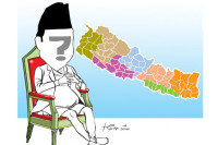
A new political map released by India has sparked controversy in Nepal as it places Kalapani within its own territory. The Government of Nepal has objected to the inclusion of Kalapani within Indian territory, and rightly so. The Foreign Ministry said that the two countries had agreed to resolve border disputes through consultation between their respective foreign secretaries. India's latest step is clearly against the agreement and is a breach of good faith.
But this is not the first time that encroachment at Lipulekh and Kalapani has been criticised. India wants to keep a close watch over Chinese movements on the border, and Kalapani seems to be strategically the best point to do so. India had built check posts at 17 places within Nepali territory in the 1950s, all of which were removed in the 1970s except the one at Kalapani in the northwest. Its national mapping authority has been including Kalapani and areas south of Lipulekh Pass since then. But Nepal has firm proof to show that Lipulekh, Kalapani and Limpiyadhura belong to it. The maps published by the then British Survey of India in 1827 and 1856 clearly show how these areas have been accepted as part of Nepal. Limpiyadhura in the north-western corner of Nepal has been accepted as the origin of the Mahakali River as per Article 5 of the Sugauli Treaty of 1816.
As per this article, the then king of Nepal renounced all claims to the territories lying west of the River Kali (Mahakali). This means that the territory besides the stated is and has always been part of Nepal. However, India is particularly interested in this part of Nepal because it is a tri-junction point where the territories of China, India and Nepal meet. The biggest mistake the Nepal government has been making is to miss the extension of Nepal's border up to Limpiyadhura.
India has also signed agreements with China by including Nepali territories like Lipulekh without Nepal's approval. Encroachment at Lipulekh as shown in the new map published by India has been going on for a very long time, but the Nepal government has never protested strongly against it. This has given India the opportunity to slowly and steadily make these areas its own. The current map is a step forward to permanently take over these lands.
Nepal should focus on raising concern over the latest Indian move, and prod international institutions to garner world interest in the issue. It would probably be foolish to rely on assurances provided by the Indian government. India should recognise the fact that Nepal has respected the Sugauli Treaty even though it was signed with the now-defunct East Indian Company. The treaty signed between the two countries should be respected, and the provisions should be followed. If India cannot uphold the notion of pacta sunt servanda ('agreements must be kept' in Latin), the Nepal government should act in its defence and start bringing out facts at United Nations gatherings.
Also, Nepal should fix its claims upon the lands and file the issue in the International Court of Justice. The principal judicial organ of the United Nations should now be considered as a resort to permanently settle the dispute created solely by the Indian government. However, Nepal relies heavily on India for many things including trade and financial support. So a harsher move by Nepal could backfire. The current situation should be tackled carefully but with vigour.
Unintelligent handling of border disputes could lead to political crises and xenophobia, which has already been fuelled by tensions on the border. Border harmony is not only about maps but also about political will and good diplomacy. Nepal and India could learn lessons from foreign disputes that were resolved like those between Uzbekistan and Kyrgyzstan, and Ethiopia and Eritrea. Both cases were resolved due to good changes in the political leadership.
It is not required that the current leaders of Nepal and India be changed, but the way they are playing with the diplomatic tie-up needs to be revitalised. India, being the bigger player here, should value its goodwill in the international arena since it is currently looking forward to becoming one of the superpowers. India is rapidly losing its neighbours as friends and is on the brink of losing its good bilateral relations with Nepal too. India should end its occupation of Nepali lands and respect the 1950 Treaty of Peace and Friendship, if it wishes to continue the sound relations it has with Nepal. Nepal, for its part, should not wait for Indian assurance but start bringing in international attention to the matter. And it l should start talks with both India and China on the matter and reach a conclusion so that the dispute ends in a harmonious way.
The current situation is an apt opportunity for mending broken relations and permanently ending border disputes. If the current leadership of Nepal stays strong and diplomatically tackles the situation to bring an end to this border encroachment, it can not only improve its relations with its neighbours and successfully establish itself as a trade bridge between the two giants, but also garner appreciation from its own citizens, many of whom are starting to become irate.
***
What do you think?
Dear reader, we’d like to hear from you. We regularly publish letters to the editor on contemporary issues or direct responses to something the Post has recently published. Please send your letters to [email protected] with "Letter to the Editor" in the subject line. Please include your name, location, and a contact address so one of our editors can reach out to you.


